
-
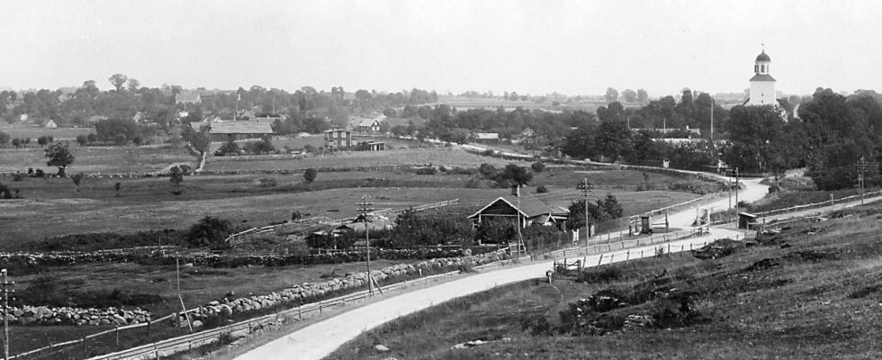
Postcard of the coastal plain in Köpingsvik, circa 1910, before tourism took off.
Köpingsvik – on historic ground
The necropolis, assembly and marketplace of Köpingsvik
Köpingsvik is probably the most archaeologically rich place on Öland. The area below the ridge, Köpinge Hed, has been used in many ways since it rose from the sea. The oldest finds are from the early Stone Age, the Mesolithic period. There is a very large and extensive settlement from the Neolithic period. There are also traces of Bronze Age settlements in the area, as well as some larger funerary monuments from the same period. From the Roman Iron Age, in the 4th century AD, until the end of the Viking Age, in the 11th century AD, there was a significant increase in burials, and a large part of the plain was then completely covered by various burial monuments.
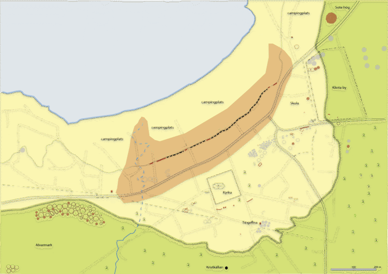
Map of existing (red) and removed ancient remains. Note: The location of removed burials is uncertain. Older cadastral maps (LMV), Hilfeling’s map of 1796 and Fornreg (ATA/RAÄ).
The bay with the old harbour was a communicative key point in the landscape, at the crossroads between central and northern Öland, where the roads from the north, east and south met. Nils Henrik Sjöborg wrote in 1824, after seeing the many and varied forms of graves at the site: ¨I suppose that this place was the general meeting, sacrifice, assembly and marketplace of the whole island…¨.
Here, on the beach plain below the crested embankment, there are still the remains of an earlier, more or less continuous, larger burial ground, which was at least one kilometer long and about 450 meters wide. A detailed map of the cemetery was drawn by Carl Gustaf Gottfried Hilfeling in 1796. His map shows about 150 graves of different types. It is therefore fair to speak of a necropolis. Unfortunately, much of it has been destroyed by the buildings that have been erected here on the coastal plain since the middle of the 20th century.
In the north-eastern edge of the area, up on the crested embankment, next to the village of Klinta, eight very richly decorated cremation graves were excavated. The graves can be dated to the end of the 8th century to the 10th century AD. All but one were women’s graves. Today, only three cairns remain, Sote hög, which was the largest of the cairns, and one to the south and west of the village site. The location of these high-status graves from at least the end of the Vendel period, may mean that it was at this time that the harbor and assembly place developed into a legally demarcated marketplace for a larger region.
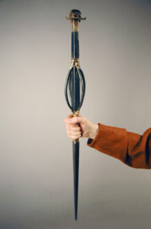
The Klinta staff, a seeress’ magical staff found in a woman’s grave, reconstruction, photo: O Kullander/SHM.
The assembly place seems to have been just south-east of the church, where the name Tingsdal is found, where Tingsflisan stands and where the farm Tingsene was established in the early 1800s. The assembly place is recorded in the Middle Ages as the ”proper” assembly place for Slättbo district, but it was undoubtedly established before the Viking Age. This must have been in the 7th or 8th century AD, possibly earlier, as the many and large burial grounds show. Köpingsvik then became the most important assembly place on the island, which is why an important marketplace developed here during this period. It stretches for about 1100 meters along the beach and is about 200 meters wide. A stone wall runs parallel to the shore through this area. It may have been built to protect the beach, or it may have formed a legal boundary between the market and the sea. It is overlain by Viking Age/Early Medieval cultural layers and must therefore belong to an older phase, the Vendel period. The peak of trade and craft activity can be dated to 1050-1150 AD and seems to have ended shortly after 1200 AD.
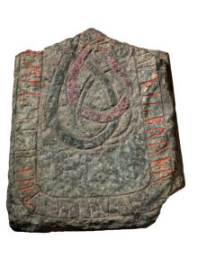
Rune stone from Köpingsvik church dated 11–1250. Photo: G Hildebrand, The Historical museum/SHM (CC BY 4.0)
In the area of the church and meeting place there were five rune stones. Two of them still exist today. When the old medieval church was demolished in 1945, 76 fragments of polished, rune-carved Christian grave monuments in the so-called Urne-style from the end of the 11th century AD were found. These were originally placed in the open air next to a wooden church. When the 42-metre-long Romanesque stone church was built at the beginning of the 12th century, these tombstones were used as building blocks. The church became not only the largest on the island, but also one of the largest in Scandinavia. It is therefore not impossible that the church functioned as the island’s cathedral before Öland became Swedish. All the evidence suggests that this only happened at the end of the 12th century, when Öland also became part of the diocese of Linköping. Later in the Middle Ages, the parish of Köping was a royal parish, which meant that the Swedish king appointed the priests in the parish.
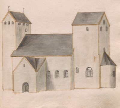
Köpingsvik’s medieval church.